
11 Easy Hikes In Squamish [2025 Guide]
Are you searching for easy hikes in Squamish? This post has you covered!
Squamish is a hiker’s paradise, offering a plethora of easy hikes that cater to all skill levels. Whether you’re a seasoned adventurer looking for a relaxing day on the trail or seeking an introduction to hiking, Squamish’s easy hikes are the perfect choice.
With its majestic mountains, dense forests, and sparkling rivers, Squamish serves as the gateway to countless outdoor adventures.
Renowned as the “Outdoor Recreation Capital of Canada,” this charming town boasts a remarkable variety of trails that showcase the region’s stunning natural wonders. I have been exploring the trails in Squamish ever since I first moved to Canada, and some of the hikes on this list make it onto my list of best hikes in Squamish.
For a peaceful escape, head to Alice Lake Provincial Park, an idyllic oasis that boasts an extensive network of trails And no visit to Squamish would be complete without experiencing the enchanting wonder of Shannon Falls, the third highest waterfall in British Columbia.
These trails provide an opportunity to explore the area’s rich biodiversity, marvel at cascading waterfalls, and soak in awe-inspiring panoramic vistas without pushing your physical limits.

Easy Hikes In Squamish
1. Four Lakes Trail

Located in Alice Lake Provincial Park, this scenic easy trail near Squamish offers a delightful adventure for hikers of all skill levels.
The Four Lakes Trail is a loop trail that spans approximately 6 kilometres (3.7 miles) in total length. It winds through a picturesque forested area, taking you past five stunning lakes: Fawn Lake, Edith Lake, Alice Lake and Stump Lake.
One of the things that make the Four Lakes Trail an easy hike is its relatively flat and gentle terrain. The trail has minimal elevation gain, making it accessible for beginners and families with children. The path is mostly compact dirt with some sections covered in tree roots, but overall, it is quite manageable for most hikers.
As you wander through the forest, you’ll be treated to breathtaking vistas of the tranquil lakes and surrounding mountains. Along the trail, you’ll find several designated picnic areas and benches where you can take a break, enjoy a snack, or simply soak in the serene ambiance.
The trail is also dog-friendly, allowing you to bring along your furry friends on a leash to share the outdoor experience.
The easy terrain, moderate length, and scenic surroundings make the Four Lakes Trail a wonderful choice for families with children.
Hike Stats:
- Length: 6.1 km
- Elevation: 146 m
- Dog Friendly: Yes – On leash
- Stroller/Wheelchair accessible: In most sections, yes.
- Route Type: Loop
How To Get There:
Alice Lake Provincial Park is accessible directly off the Sea to Sky Highway and is approximately 76km north of Vancouver. The park is well signposted and will be on the right hand side.
2. Shannon Falls

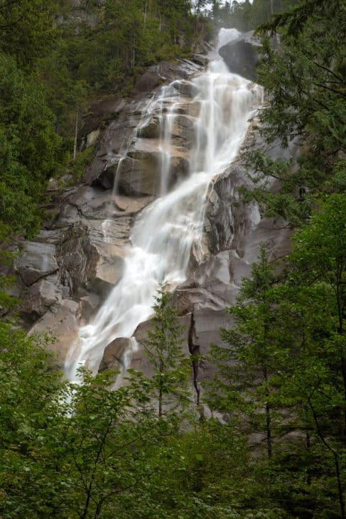
The Shannon Falls trail in Squamish offers a remarkable opportunity to witness the grandeur of one of British Columbia’s most impressive waterfalls. As the third highest waterfall in British Columbia, Shannon Falls is a majestic natural wonder that draws in crowds year-round.
Calling this a hike is a stretch, as it’s actually a very short walk, but I have included it on this list of easy hikes in Squamish as I think everyone should experience the majesty of Shannon Falls.
The Shannon Falls trail is a well-maintained and clearly marked out-and-back trail that stretches approximately 1.5 kilometres (0.9 miles) in length. The trail starts from the parking lot and gently ascends to the base of the waterfall.
The waterfall plunges down an impressive 335 meters (1,099 feet), cascading with tremendous force. The Shannon Falls trail is surrounded by lush coastal rainforest, including tall cedar, hemlock, and fir trees that tower above.
This easy hike in Squamish involves minimal elevation gain making it accessible to hikers of all fitness levels. The trail is well-paved and wide, accommodating strollers and wheelchairs. The parking lot provides accessible facilities such as restrooms and picnic areas.
Hike Stats:
- Length: 1 km
- Elevation: 39 m
- Dog Friendly: Yes – On leash
- Stroller/Wheelchair accessible: Yes
- Route Type: Loop or out and back
How To Get There:
Located just off the Sea to Sky Highway, the Shannon Falls trail is easily accessible and conveniently situated between Vancouver and Whistler. It is approximately 60 km north of Vancouver.
3. Murrin Loop & Quercus Viewpoint


Located in the picturesque area of Murrin Provincial Park, just a short drive from downtown Squamish, this trail is a favourite among locals and visitors alike.
One of the highlights of the Murrin Loop Trail is the Quercus Viewpoint, which offers panoramic vistas of Howe Sound, the surrounding mountains, and the nearby Stawamus Chief.
The trail winds its way through the woods, gradually ascending to higher elevations. I first did this hike around 2019 before it blew up on social media, and have always referred to it as “The mini chief” because there some big steps on the way to the first viewpoint, which is similar to that of the Stawamus Chief hike.
The viewpoint is situated at an elevation that provides an incredible vantage point to take in the natural beauty of the region. On clear days, you can see the sparkling waters of Howe Sound stretching out before you, with the coastal islands dotting the horizon.
Browning Lake, located along the trail, is a popular spot for swimming, picnicking, and fishing during the warmer months. You can also find several picnic tables and benches scattered around the lake, providing great spots to rest and enjoy a packed lunch.
It’s worth noting that while the Murrin Loop Trail and Quercus Viewpoint are accessible year-round, the best time to visit is during the spring, summer, and fall seasons.
Hike Stats:
- Length: 2.4 km
- Elevation: 162 m
- Dog Friendly: Yes – On leash
- Stroller/Wheelchair accessible: No – but Browning like is.
- Route Type: Loop or out and back
How To Get There:
Murrin Provincial Park is incredibly accessible. It is approximately 56 km from Vancouver and the entrance is directly off the Sea to Sky Highway. The park will be on your left if heading north.
4. Smoke Bluffs

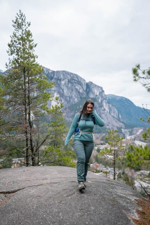
The Smoke Bluffs trail offers a delightful and easy hike in Squamish that showcases the region’s renowned rock climbing routes.
The trail is a loop that spans approximately 2.5 kilometres (1.6 miles) in length. It winds through the Smoke Bluffs Park, a picturesque area filled with towering granite cliffs and lush forested surroundings. The trail is well-maintained and wide for the most part.
The trail has minimal elevation gain, consisting of mostly flat and well-packed dirt paths. The absence of steep inclines or challenging obstacles makes it suitable for hikers of all ages and fitness levels.
The highlight of the Smoke Bluffs Trail are the several panoramic views of Squamish and the surrounding mountains, including the iconic Stawamus Chief.
It’s important to note that there are many biking & hiking trails that intertwine with the Smoke Bluffs trail and certain areas can be harder to navigate. I’d recommend bringing a GPS as I have tried some of the other trails and they can be very steep here.
Hike Stats:
- Length: 2.7 km
- Elevation: 193 m
- Dog Friendly: Yes – On leash
- Stroller/Wheelchair accessible: No
- Route Type: Loop or out and back
How To Get There:
If driving the Sea to Sky Highway north from Vancouver, turn in at Logger’s Lane and continue past the Squamish Adventure Centre. A few minutes past the Adventure Centre there will be parking signposted for Smokes Bluffs Park. The trailhead starts from the parking lot.
5. Brohm Lake Trail


With a vast expanse of 19 km worth of trails, Brohm Lake Interpretive Forest offers ample opportunities for exploration. Most visitors opt for a 4 km loop that encircles the lake or an 8 km loop that includes the lake and showcases various viewpoints.
The Brohm Lake Loop is a relatively easy route with some stairs, spanning 4 km and featuring a modest 30 m elevation gain. Budget a little over 1 hour to complete this loop and fully immerse yourself in the natural beauty surrounding the lake.
For those seeking an additional adventure, the Tantalus View Trail presents a short but steep side trail that branches off from a point along the lake’s perimeter. This trail leads to a bluff viewpoint and an old fire lookout.
Adding approximately 1.5 km round trip and 100 m of elevation gain to the Brohm Lake Loop, this detour is worth the effort. Plan for 30 to 45 minutes to fully appreciate the scenic rewards of the Tantalus View Trail.
During the summer, Brohm Lake is an excellent place to go for a swim or for paddle sports. One of the thrilling activities enjoyed by visitors is cliff jumping, with several spots around the lake offering cliffs as high as 12 meters (40 ft).
I would recommend GPS for this trail as there are many trails intertwined here and it is easy to veer off trail. If you are visiting with strollers and/or have mobility issues, the beach area at Brohm Lake is a short easy walk with picnic tables, and is a great way to experience the lake with minimal effort.
Hike Stats:
- Length: 3.5 km (Brohm Lake Loop) 4.8 km (Tantalus View Trail)
- Elevation: 67 m (Brohm Lake Loop) 176 m (Tantalus View Trail)
- Dog Friendly: Yes – On leash
- Stroller/Wheelchair accessible: No
- Route Type: Loop or out and back
How To Get There:
6. Mount Crumpit
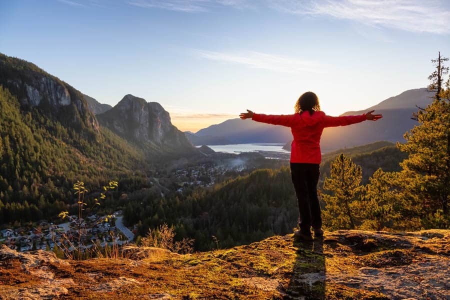
Mount Crumpit is the hardest hike on this list, and while some people may not consider this an easy hike, I have included it because for experienced hikers and those with a good fitness-level this may be considered an easy hike in Squamish.
The trail is located next to the Stawamus Chief and offers several viewpoints that look towards the Chief, Howe Sound, and across the town of Squamish towards several of the mountains to the west.
The trail is relatively short, steep, and rocky, providing a challenging climb for hikers. The hike to the top of Mount Crumpit takes only a few hours, making it a great option for those who want to enjoy a rewarding hike without spending the entire day on the trail.
Hikers can enjoy a variety of scenery along the trail, including a walk through a beautiful forest and stunning views from the top. The trail is open year-round, making it a great option for hikers no matter the season.
The trails through Crumpit Woods are not well sign-posted and I did get lost here even with GPS. If you are attempting this hike, download the AllTrails map. I recommend taking this hike counter-clockwise so that you ascend the steepest part first. Coming down this part was not fun!
Hike Stats:
- Length: 4.7 km
- Elevation: 263 m
- Dog Friendly: Yes – On leash
- Stroller/Wheelchair accessible: No
- Route Type: Loop
How To Get There:
To access the Mount Crumpit Trail, drive north on Highway 99 before turning right off the highway onto Guildford Drive and continuing on until you reach Westway Avenue where you’ll turn left. Access to the trailhead is through Crumpit Woods on Cherry Drive. This is a residential area, so please be respectful.
7. Squamish Estuary Nature Trail
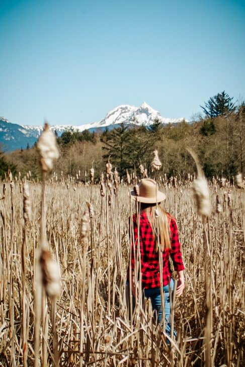

The Squamish Estuary Nature Trail is a loop trail that stretches approximately 2 kilometres (1.2 miles) in length. It meanders along the banks of the Squamish River, offering a pleasant and leisurely stroll through wetlands, marshes, and forested areas.
This picturesque trail allows you to explore the diverse ecosystem of the Squamish Estuary while immersing yourself in the surrounding natural beauty. The trail is well-marked and mostly flat, making it easy to navigate.
The Squamish Estuary is a haven for wildlife, attracting a diverse range of bird species and other animals. As you stroll along the trail, keep an eye out for feathered friends such as bald eagles, herons, and various waterfowl.
The trail is designed to accommodate people with mobility challenges, ensuring that everyone can experience the beauty of the estuary. It is paved and offers a smooth surface, making it suitable for strollers and individuals with limited mobility.
The Squamish Estuary Nature Trail is located in close proximity to downtown Squamish, making it easily accessible for locals and visitors alike.
Hike Stats:
- Length: 3.2 km
- Elevation: 9 m
- Dog Friendly: Yes – On leash
- Stroller/Wheelchair accessible: Yes
- Route Type: Loop
How To Get There:
Drive the Sea to Sky Highway to Squamish town. Once you arrive make your way to Cleveland Avenue and then turn left onto Pemberton Avenue. Continue until you reach Vancouver Street, turn left and continue untilyou reach the parking lot for Squamish Estuary.
8. Coho Park Trail
Spanning a manageable distance of 2.7 kilometres (1.7 miles), the Coho Park trail showcases the natural beauty of the area and is suitable for hikers of all ages and skill levels. It’s an easily accessible and family-friendly hike that provides a refreshing escape into nature.
Families with young children will find the Coho Park Trail particularly appealing. The well-maintained paths and moderate difficulty level allows everyone to comfortably explore the outdoors.
The highlight of this route is a magnificent waterfall, which you can almost touch as you cross a bridge just a few meters in front of it
Upon starting the hike, you’ll traverse a system of boardwalks and ascend a short dirt hill before reaching a marked junction. At this point, veer left onto The Covenant Trail, where you’ll soon come across two small bridges.
It’s the second bridge that serves as the climactic moment of the route, providing an up-close view of the stunning waterfall.
The entire CoHo Park walking trail route covers approximately 4.5 kilometres (2.8 miles) and typically takes around 1.5 to 2 hours to complete, depending on your pace and the amount of time spent enjoying the scenery.
Hike Stats:
- Length: 2.4 km
- Elevation: 66 m
- Dog Friendly: Yes – On leash
- Stroller/Wheelchair accessible: Yes
- Route Type: Loop
How To Get There:
From the Sea to Sky Highway make a right turn at Mamquam Road and continue for approximately 600 meters. Then, turn left onto Garibaldi Way before making a right turn onto Parkway Road. Afterward, turn left onto Park Crescent and continue until you reach the bend in the road. At the edge of the trees, you’ll find the trailhead on the right.
9. Mamquam Falls
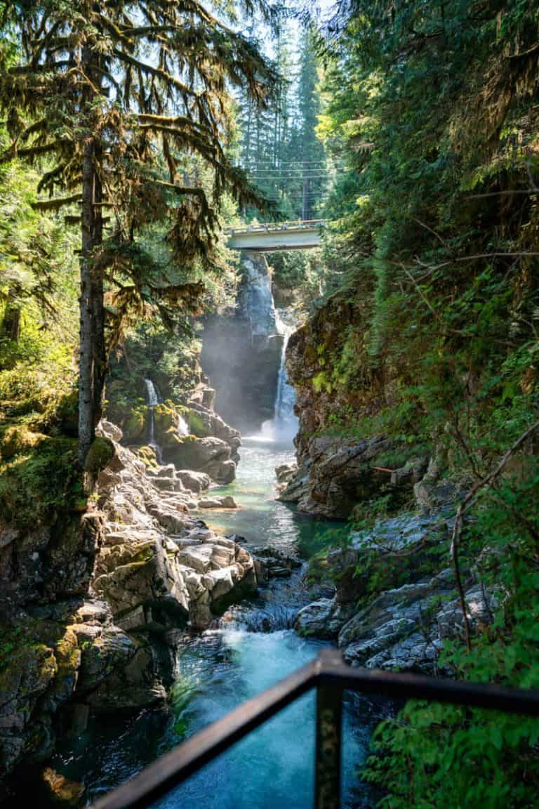
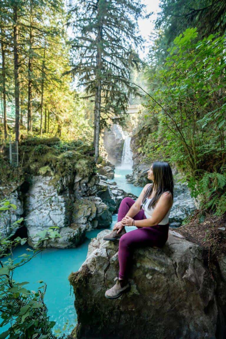
The Mamquam Falls trail is a hidden gem nestled in the picturesque wilderness of Squamish. At only 1.6km in length and an elevation of 60 metres, it is one of the easiest short hikes in Squamish.
While it may not boast the grandeur of some of the larger waterfalls, standing at 62 feet in height, its charm lies in the journey to reach it. The hike takes you through a lush rainforest, weaving through a captivating canyon, and alongside the mesmerizing emerald green waters.
This trail is perfect for families or those seeking an easy-rated hike, as it offers a rewarding experience without being too strenuous.
Although this hike is one of the easiest on this list, the trail does descend steeply (but shortly!) in some areas. My most recent trip here I did in Tevas, and although it was fine I would still recommend some sort of hiking boot or sturdy shoes with good grip.
Hike Stats:
- Length: 1.9 km
- Elevation: 65 m
- Dog Friendly: Yes – On leash
- Stroller/Wheelchair accessible: No
- Route Type: Loop or out and back
How To Get There:
Mamquam Falls can be reached by taking a scenic drive along the Sea to Sky Highway. After traveling along this renowned route, you’ll come across the Mamquam River Forest Service Road.
Follow this road for approximately 3.7 km until you reach the first major intersection. Take a left turn at this point and continue along the service road for an additional 1.7 km. You’ll then come to a large yellow gate with a parking area conveniently located to its left. This is the trailhead.
10. Wonderland Lake Loop Trail
The Wonderland Lake trail is located at the top of the Sea to Sky Gondola in Squamish and offers a hiking experience suitable for all fitness levels.
To access the trail, hikers have the option of either hiking up the long distance from the base or purchasing a gondola ticket. Once at the top, hikers can easily locate the trailhead by following the well-marked signs.
As you venture along the trail, numerous viewpoints offer stunning panoramas of the surrounding mountains, including the Summit Lodge, Sky Pilot and Co-Pilot Mountains, and Goat Ridge.
One of the highlights of the Wonderland Lake trail is, of course, the picturesque Wonderland Lake itself. This serene lake is adorned with lily pads and framed by wildflowers and Alaskan Blueberry bushes.
The trail then transitions into a captivating boardwalk that encircles the lake, allowing you to experience rich flora and fauna of the local ecosystem.
With a total distance of 1.6 kilometres and an elevation gain of 40 meters, the Wonderland Lake trail is a manageable hike that can be completed within approximately 30 to 60 minutes. Its gentle terrain and well-maintained pathways make it suitable for hikers of all ages and fitness levels
Hike Stats:
- Length: 1.6 km
- Elevation: 40 m
- Dog Friendly: No – dogs are not allowed on any hiking trails at the top of the Sea to Sky Gondola
- Stroller/Wheelchair accessible: Yes
- Route Type: Loop
How To Get There:
To access the trailhead, visitors can drive north on BC-99 N. After 8.0 kilometres, make a right turn into the parking lot for the Sea to Sky Gondola. Once there, a gondola ticket must be purchased to reach the top, where the trailhead awaits on the left side.
11. DeBeck’s Hill
The DeBecks Hill trail follows an old logging road that was originally constructed by Dennis DeBeck for his small-scale sawmill operation. The hill itself is named after Dennis DeBeck, and as you make your way along the trail, you’ll encounter remnants of his sawmill operation.
This 4.3-kilometer (2.7-mile) out-and-back trail is generally considered moderately challenging, with an average completion time of approximately 1 hour and 44 minutes.
The trail leading to the summit of DeBecks Hill is known as DeBecks Grind, and it serves as a multi-use trail suitable for various activities, including mountain biking, hiking, trail running, snowshoeing, and skiing.
Hike Stats:
- Length: 4.3 km
- Elevation: 277 m
- Dog Friendly: Yes – On leash
- Stroller/Wheelchair accessible: No
- Route Type: Out and back
How To Get There:
To access the trailhead for the DeBeck’s Hill route, start from the parking lot located at the southern tip of Alice Lake. To reach Alice Lake from Squamish, head north on BC-99 N and take a right turn onto Alice Lake Road. Follow this road for approximately 1.6 kilometres until you reach the trailhead, which will be on your right-hand side.
FAQ: Easy Hikes Squamish
How hard is The Chief hike in Squamish?
Ascending the Chief is no small feat. Rated as an intermediate hike, it presents a challenge that requires determination and some technical skills. To conquer the First and Second Peaks, you’ll encounter sections of the trail where chains and ladders are strategically placed to assist you in navigating the more demanding terrain.
It’s important to exercise caution, especially when the rocks are wet and slippery, as the steep drop-offs from the summits plunge hundreds of feet below. Stay mindful of your surroundings and take appropriate measures to ensure your safety.
How long is the hike to Shannon Falls?
The hike to Shannon Falls is relatively short and straightforward. The trailhead is located near the parking lot, making it easily accessible for visitors. From the trailhead, it takes only a few minutes to reach the base of Shannon Falls. The total round-trip distance for the hike is approximately 0.6 kilometers or 0.4 miles.
How long is the Four Lakes trail Squamish?
The Four Lakes Trail is an easy 6.5 km loop that takes you on a meandering journey through enchanting creeks, flourishing second growth forests, and introduces you to the beauty of four distinct mountain lakes.
Can a beginner do the Chief hike?
This is dependent on fitness level. This challenging hike incorporates elements such as ladders, chains, and ropes, which add an intriguing aspect to the trail. While these features make it less accessible for beginners, they undoubtedly enhance the overall experience, adding an element of excitement and adventure to the hike.
How long is the walk around Alice Lake?
The Alice Lake loop trail is a 1.1-mile hike and is widely regarded as an easy route, making it accessible to a wide range of hikers. With a moderate pace, it typically takes around 21 minutes to complete the loop.
Can a beginner do a 7-mile hike?
Determining an exact distance for beginners can vary, but a helpful guideline to gradually build your hiking endurance is to begin with hikes within the 5-mile range. By starting with shorter distances and progressively increasing, you can develop your stamina and confidence at a manageable pace. This general rule of thumb suggests that opting for hikes of 5 miles or less is an ideal starting point, allowing you to comfortably explore the outdoors while gradually expanding your hiking capabilities.
Explore More Of British Columbia
Want to explore more of British Columbia? Check out these other detailed travel guides!
Click A Pin Below To Save For Later!
About Rachael
Welcome to A City Girl Outside! I’m Rachael, a Londoner who traded the hustle and bustle of city life for the breathtaking beauty of Whistler, Canada. With no prior experience, I dove headfirst into an outdoor lifestyle that now includes hiking, canoeing, and snowshoeing.
What started as a leap into the unknown has become my greatest passion. These days, you’ll find me spending my weekends adventuring in the Canadian wilderness—chasing alpine views, paddling serene lakes, and embracing all that nature has to offer.
A City Girl Outside aims to inspire readers to step beyond their comfort zones, explore the great outdoors, and embrace the wild. Whether you’re a seasoned explorer or a complete beginner like I once was, there’s always room to reconnect with nature and discover the adventurer within.


![53 Best Things To Do In Whistler In Summer [2025]](https://acitygirloutside.com/wp-content/uploads/2020/02/Summer-in-Whistler-768x512.jpg)
